
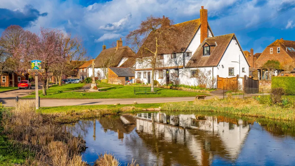
This is a plain run-through of the villages near Wantage: which direction each one sits in, how far out it is, and what you will actually find when you get there. It is written for people deciding where to live, newcomers working out the geography, and anyone planning a slow afternoon in the lanes.
Wantage sits in a ring of small places, most of them within a few miles. Some have a school and a pub. Some are a handful of houses and a church. Knowing which is which saves a wasted drive.
Villages Near Wantage: Key Distances
| Closest village | Charlton – 1.3 km east |
|---|---|
| Furthest covered (west) | Uffington – 9.5 km west |
| Furthest covered (east) | Milton – 9.8 km north-east |
| Largest neighbour | Grove – 2.1 km north |
| Total places covered | 30 towns & villages |
The short version
- The site covers 30 towns and villages around Wantage, from Charlton at 1.3 km to Milton at 9.8 km.
- Closest of all: Charlton to the east, East Challow to the west and Grove to the north.
- Grove is the biggest neighbour and the place changing fastest, with thousands of homes being built on its edges.
- Walks start in Uffington, Ardington, Letcombe Bassett and East Challow, not only in town.
- Village pubs, shops and schools change, so check the live lists on the page rather than trusting an old leaflet.
Villages near Wantage at a glance
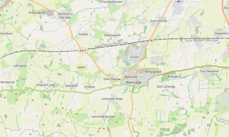
Distances below are straight lines from Wantage Market Place, so the road route is always a little longer. The direction tells you which way to leave town.
| Village | Distance and direction | Worth knowing |
|---|---|---|
| Charlton | 1.3 km east | Closest village to the town centre, with a primary school. |
| East Challow | 1.8 km west | Primary school; the canal towpath walk starts here. |
| Grove | 2.1 km north | Largest neighbour: shops, schools and most of the new housing. |
| Letcombe Regis | 2.2 km south-west | On the brook, with footpaths on towards Letcombe Bassett. |
| Ardington | 3.4 km east | Start point for routes across the Lockinge estate. |
| Childrey | 3.7 km west | Primary school; paths link it back through the Challows. |
| Letcombe Bassett | 3.8 km south-west | Where the longer hill walks begin, including Segsbury Camp. |
| Denchworth | 4.3 km north-west | The nearest village out to the north-west. |
| East Hanney | 5.5 km north | Primary school and a completed housing site of about 216 homes. |
| East Hendred | 6.3 km east | Two primary schools and walks up onto the ridge. |
| Harwell | 9.4 km east | Primary school, with the science campus close by. |
| Uffington | 9.5 km west | Primary school; White Horse Hill and Uffington Castle walks start here. |
West of town: the Challows, Childrey and Uffington
West is the direction for small places strung along the foot of the chalk. East Challow is barely out of town at 1.8 km, and West Challow follows at 3.2 km. Childrey sits at 3.7 km, with Sparsholt at 5.2 km and Kingston Lisle at 7.3 km beyond it.
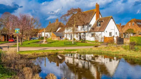
The village pond, Childrey 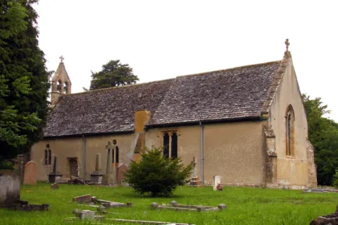
St Laurence Church, West Challow Photo: Steve Daniels, CC BY-SA 2.0, via Wikimedia Commons 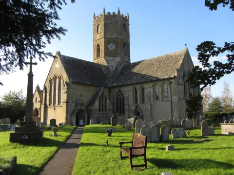
St Mary's Church, Uffington Photo: Gareth James, CC BY-SA 2.0, via Wikimedia Commons
Keep going and you reach Uffington, 9.5 km west and the furthest village this way that the site covers. It is the usual base for a walk up to the white horse, and a fair drive rather than a stroll. If you want a shorter version of the same scenery, the Childrey and Challow lanes give you open views without the climb.
East of town: the Lockinges, Ginges and Hendreds
East of Wantage the villages come in pairs. West Lockinge is 2.4 km out and East Lockinge 2.7 km; West Ginge is 4.7 km and East Ginge 5.1 km. West Hendred sits at 5 km, with East Hendred at 6.3 km, and Ardington between them at 3.4 km.
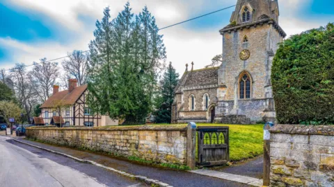
Holy Trinity Church and the Boar's Head, Ardington 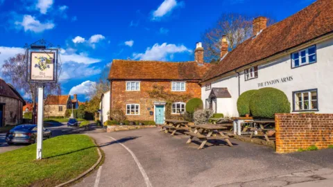
The Eyston Arms, East Hendred 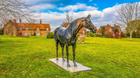
Best Mate's statue, Lockinge
East Hendred is the largest of the group and the one most day visitors aim for, partly because footpaths run from it up to the ridge. Further out, Farnborough is 7 km to the south-east, Harwell 9.4 km east and Milton 9.8 km north-east. Harwell and Milton matter to a lot of households here because of the jobs at the Harwell Campus expansion and at Milton Park, both approved projects at the last check in 2025 and 2026.
North: Grove, the Hanneys and Charney Bassett
North is where the built-up area really continues. Grove is 2.1 km from the Market Place and has its own shops, schools and a growing edge of new estates. Kingsgrove, 1.9 km north-east, is a new neighbourhood rather than an old village.
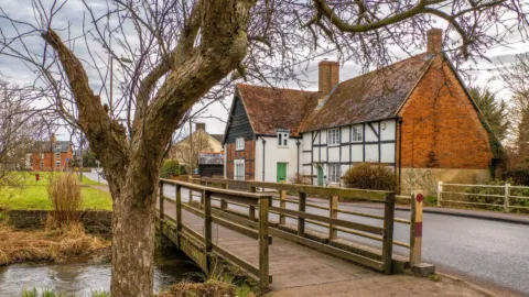
Footbridge over the Letcombe Brook, Grove 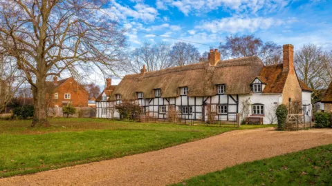
East Hanney 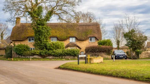
Thatched cottages, Charney Bassett
Past Grove the countryside opens up again: West Hanney at 5.1 km, East Hanney at 5.5 km, Lyford at 6.4 km and Charney Bassett at 6.9 km. Steventon, 8.2 km north-east, is the one closest to the main line railway and the A34 corridor.
Good to know: the Hanneys and Steventon are the villages most affected by the proposed White Horse Reservoir (SESRO), which was still in planning at the last check in September 2026.
South: the Letcombes and the Fawleys
South of town the land rises, so these are the villages for walkers. Letcombe Regis is 2.2 km south-west and Letcombe Bassett 3.8 km, both strung along the Letcombe Brook valley. Fawley is 6.6 km due south and South Fawley 7.7 km, high up and well away from the main roads.
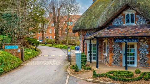
Letcombe Regis 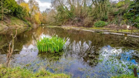
The cress beds, Letcombe Bassett 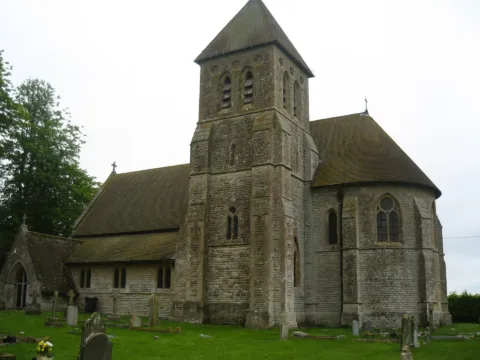
St Mary the Virgin Church, Fawley Photo: Philipjelley, CC BY-SA 3.0, via Wikimedia Commons
There is less here in the way of shops and services, which is the trade-off. What you get instead is a short walk from your door onto the old track that runs along the top.
Village pubs, shops and eating out
Most villages near Wantage have one pub at most, and not every village has one. That is the honest picture, and it is why a current list beats a printed guide. The directory keeps pubs by village, with features such as a garden or a roast, so you can see what is listed before you set off.
Browse the pubs category for the whole area, or narrow by Sunday lunch or dog friendly places if that is what decides it. Listings on wantage.com are free, and Featured listings are always labelled.
 The Greyhound InnPlaces to stay · Letcombe RegisBreakfast · Dog friendly · Family friendly
 The Boar’s HeadPubs & bars · ArdingtonGarden or outdoor seating · Sunday lunch
 The Chequers InnPlaces to stay · Charney Bassett
 The Black HorsePubs & bars · East HanneyChildren’s play area · Dog friendly · Family friendly
 The Plough at HanneyPubs & bars · West HanneyGarden or outdoor seating · Private hire · Sunday lunch
 The Eyston ArmsPubs & bars · East HendredFamily friendly · Garden or outdoor seating · Private hire
 The WheatsheafPubs & bars · East HendredDog friendly · Garden or outdoor seating · Private hire
 The Lord NelsonPubs & bars · CharltonDog friendly · EV charging · Family friendly
 The Extraordinary HarePubs & bars · West HendredAfternoon tea · Breakfast · Family friendly
 The Fox InnPubs & bars · DenchworthChildren’s play area · Dog friendly · Family friendly
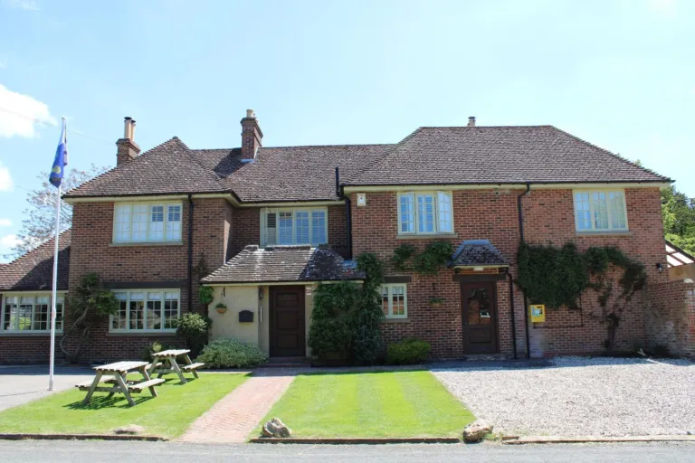 The Blowing Stone InnPlaces to stay · Kingston Lisle
- TThe Fox and Hounds, UffingtonPubs & bars · Uffington
- TThe HatchetPubs & bars · Childrey
 Childrey StoresCafés & tearooms · ChildreyGarden or outdoor seating · Takeaway
 Hanney Community Shop and Post OfficeSupermarkets, village shops & post offices · East Hanney
- HHendred Store and Post OfficeSupermarkets, village shops & post offices · East Hendred
- TThe Grocer Chef (Snowberry Stores & Cafe), ArdingtonCafés & tearooms · ArdingtonAfternoon tea · Breakfast · Family friendly
Walks that link the villages
Footpaths are the cheapest way to see several villages in one go. Mapped routes start in Uffington, Ardington, Letcombe Bassett, East Challow and Childrey, and a couple of them string two or three places together on one loop.
If you have an hour or two, the shorter routes suit a first look at the lanes. The longer ones climb onto the Ridgeway and give you the view back over the Vale towards Wantage. Two good examples: The Hendreds and Ardington at 4.3 miles (6.9 km), easy, from Ardington; and Letcombe Brook, Letcombe Bassett and Green Road at 3.6 miles (5.8 km), moderate.
- Letcombe Brook, Letcombe Bassett and Green Road 3.6 miles · Moderate
- The Wantage Arm and the Wilts & Berks Canal 4.2 miles · Easy
- The Hendreds and Ardington 4.3 miles · Easy
- The Devil’s Punchbowl and Hackpen Hill 5.3 miles · Moderate
- West Ilsley, Scutchamer Knob and the Ridgeway 5.7 miles · Moderate
- Childrey and the Challows from Wantage 7.2 miles · Easy
The full set, shortest first, is on the walks pages, each with parking and step-by-step directions.
Schools in the villages
Several villages have their own primary school, which is often the deciding factor for families. Millbrook Primary School in Grove and The Hendreds Church of England School in East Hendred were both graded outstanding by Ofsted at the last check in November 2023.
To the west, St Nicholas CofE Primary School in East Challow was graded good in January 2023, and The Ridgeway Church of England Primary School in Childrey good in March 2024. Secondary-age children from most of these villages travel into town or into Grove; King Alfred’s Academy is the Wantage secondary, and its latest Ofsted report does not give a single overall grade (checked April 2026).
Grades and inspection dates move, so use the schools and nurseries pages for the current position, and check catchment with the county council before you commit to a house.
New housing and roads around the villages
Growth is concentrated north of Wantage rather than spread evenly. Grove Airfield (Wellington Gate) was being built at the last check in September 2026, with about 2,500 homes planned by Persimmon Homes, plus a secondary school, primary schools and a local centre. Monks Farm in north Grove was also being built (checked June 2026), with about 885 homes and a section of new link road.
On the other side of town, Kingsgrove (Crab Hill) was being built in September 2026, with about 1,534 homes. The Grove Northern Link Road was approved at that same check, and it will change how traffic from the northern villages reaches the A338 and the A420.
- Grove Airfield (Wellington Gate), GroveBeing built (Sep 2026)2,500 homes · Persimmon Homes
- Kingsgrove (Crab Hill), north-east WantageBeing built (Sep 2026)1,534 homes · St Modwen
- Monks Farm, north GroveBeing built (Jun 2026)885 homes · David Wilson Homes
- North West of GroveIn planning (Sep 2026)624 homes · Persimmon Homes
- Stockham Farm housing, west WantageComplete (Apr 2026)380 homes
- Land east of Grove (300 homes, refused)Refused (Mar 2023)300 homes · David Wilson Homes
In the villages themselves the scale is smaller. New housing in East Hanney, about 216 homes, was recorded as complete in April 2026. The developments pages carry the status of each scheme with the month it was last checked.
Choosing a village, and checking before you go
If you are comparing villages near Wantage with a move in mind, the practical questions are usually the same few. Work through these before you book a viewing.
- Which primary school serves the village, and when was it last inspected.
- Whether there is a shop or a pub, or whether every loaf means a drive into town.
- How you would get to work, and which direction that pulls you: east towards Harwell and Didcot, or north towards Abingdon.
- Whether there is a pavement the whole way into Wantage or Grove, if you want to walk or cycle it.
- Whether a large site nearby is being built or still in planning, and what that will mean for the lane you live on.
For a visit rather than a move, keep it simple:
- Pick a direction and a distance from the table above.
- Open the village page to see what is listed there.
- Check the opening days on the pub or shop listing, and ring if you are travelling specially.
- Look at What’s on for fetes, markets and village hall dates.
Opening patterns in small villages change with the season and with staffing, so a quick call saves a long detour. When you have found a place you like, the Wantage town page and the other village pages are the best next step, and the other guides cover eating out, walks and family days in more detail.


