
Up to Uffington Castle
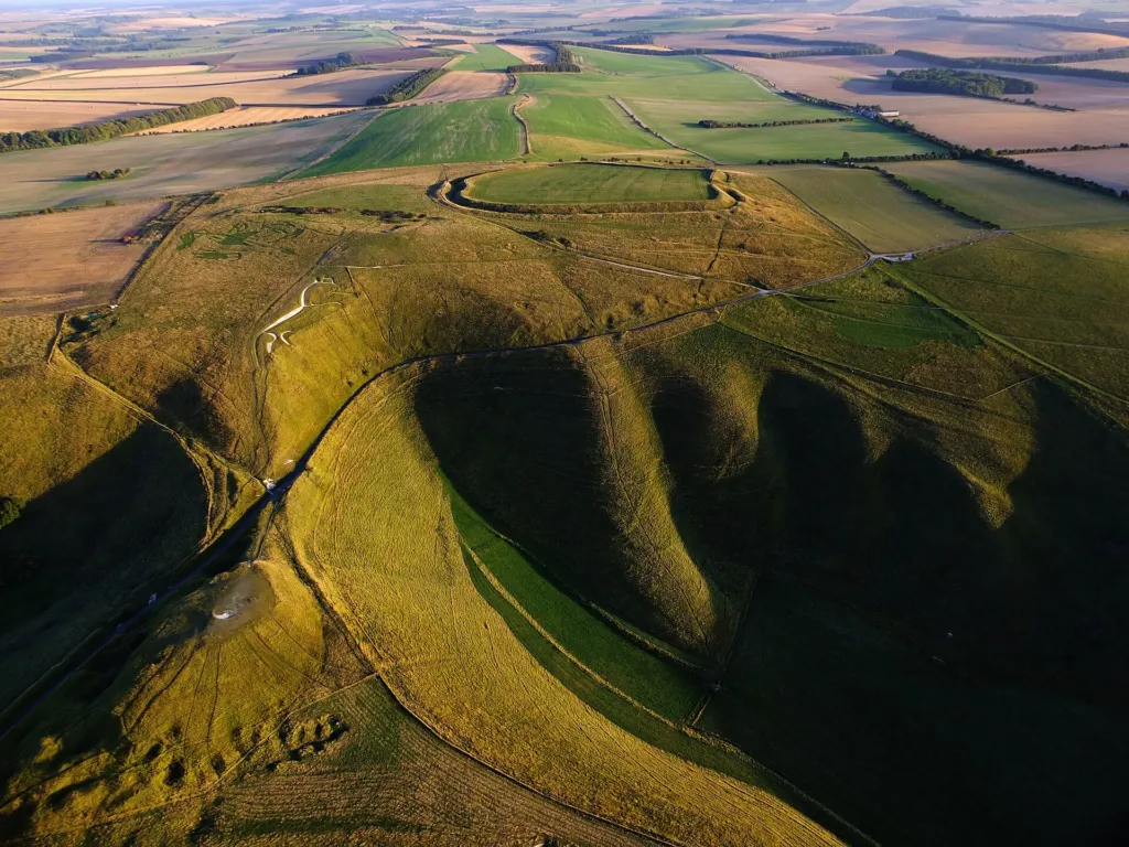
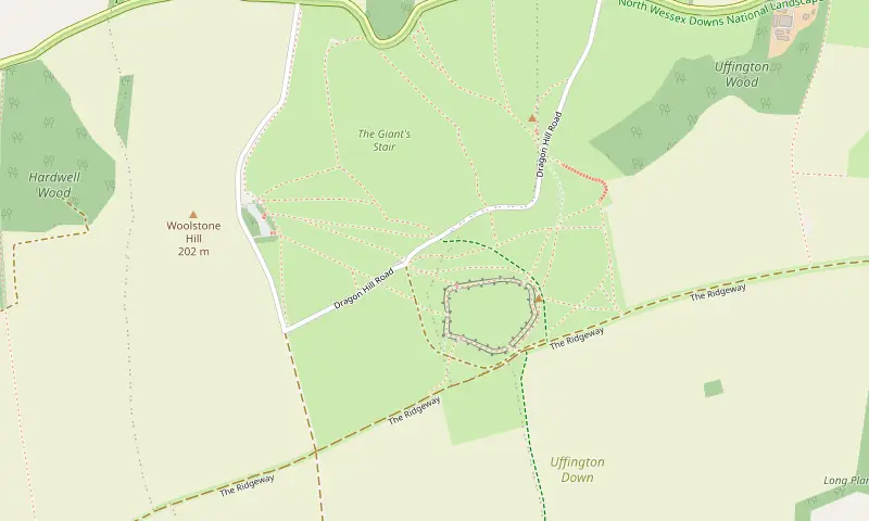
From the top of the car park we take the path east across the grass towards the long bank of Uffington Castle, climbing gently all the way. The fort is an Iron Age hillfort with a single big rampart and ditch enclosing the top of the hill. It sits at over 250 metres, one of the highest points in Oxfordshire. We walk up onto the rampart and follow it round the southern side. The Ridgeway runs just below it on the right, and to the left the whole Vale of White Horse opens out.
Above the White Horse
From the eastern side of the fort we head north and downhill towards the White Horse. The figure is about 110 metres long and cut into the slope just below the crest, so from here we see only parts of it: a stretch of beaked head, a flowing line of back or leg. Optically stimulated luminescence dating of the chalk fill in 1990 showed that it was first made between about 1380 and 550 BC, which makes it the oldest known chalk figure in Britain. It survives because people have scoured and re-chalked it for centuries, a custom the National Trust keeps up with volunteer chalking days. Please keep off the figure itself.
Dragon Hill and the Manger
Below the horse, steps and a steep path lead down to Dragon Hill, a small natural knoll with a flattened top. Legend says St George killed the dragon here and that grass will not grow where its blood fell; there is indeed a bare chalk patch on top. From Dragon Hill we look into the Manger, the deep, smooth-sided dry valley beneath the horse, with the rippling terraces known as the Giant’s Stair on its far side. Local lore says the horse comes down to graze here at night.
Back to the car park
We climb back up from Dragon Hill to the lane and follow the path beside Dragon Hill Road south-west, then cut across the grass back to the car park. The climb is steep but short; stop and look back for the best view of the Manger and Dragon Hill together.
What to look out for
The steep turf around the horse and the Manger is unimproved chalk grassland. In June and July it has pyramidal and common spotted orchids, wild thyme, harebells and knapweed, and butterflies including marbled whites and, in late summer, chalkhill blues. Red kites and buzzards soar along the scarp all year. Skylarks sing over the hilltop from February into July. On clear days the view north reaches the Cotswold edge, and the folly tower on Faringdon Hill is easy to pick out to the north-west.
Before you go
The site is open from dawn to dusk. There are no toilets or refreshments on the hill, so plan to eat in Woolstone, Uffington or Wantage. The top is windy and exposed; take a layer even in summer. Wear shoes with grip, because the grass slopes to Dragon Hill are slippery when wet or frosty. OS Explorer 170 covers the hill.
Make it longer or shorter
For the shortest visit, walk from the car park to the fort and the viewpoint above the horse and come back the same way (about 1 mile). For a longer walk, follow the Ridgeway west to Wayland’s Smithy, a Neolithic long barrow, and back (an extra 3 miles). You could also combine this loop with our Woolstone walk.


