
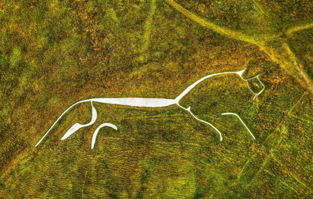
If you want to see the chalk horse cut into the Downs west of Wantage, this page is for planning it. It is written for families with an hour to spare, dog walkers and visitors who fancy a full day on the hills. An Uffington White Horse walk can be a 1.7 mile loop or a long ridge route, and the hilltop holds three things at once: the horse, an Iron Age hillfort and the flat-topped mound called Dragon Hill.
The short version
- The short mapped loop, White Horse Hill, Uffington Castle and Dragon Hill, is 1.7 miles (2.7 km) and graded moderate. Allow about an hour, plus time at the top.
- Uffington sits about 6 miles (9.5 km) west of Wantage Market Place in a straight line, so allow longer by road.
- You cannot see the whole horse from the hilltop. The shape reads best from the vale below or from a distance.
- Longer options from the same hill take in Wayland’s Smithy at 5.1 miles, or the ridge back towards town at 9.7 miles.
- The chalk turns slick after rain and the ridge is open to the wind, so take grip and a windproof layer.
How long the Uffington White Horse walk takes
Allow about an hour for the short loop. The mapped route on this site, White Horse Hill, Uffington Castle and Dragon Hill, is 1.7 miles (2.7 km) and graded moderate. The climb is short but steep in places, so small children, anyone with a camera and anyone who stops to read the view will take longer.
Give yourself extra time at the top. Most of the pleasure is standing still: the grassy ramparts, the long view north over the Vale of White Horse, and the drop into the dry valley below the horse. With the drive from town at each end, a short visit still fills a half day.
Want more on your feet? The 5.1 mile round by Woolstone and Wayland’s Smithy adds a Neolithic long barrow, and the 9.7 mile Ridgeway route to Wantage is graded challenging; the site lists its start at Letcombe Bassett rather than on the hill itself.
Routes compared, 1.7 to 9.7 miles
An Uffington White Horse walk can mean several different days out, so pick by distance and grade rather than by name. The routes below all touch this stretch of hill.
Uffington White Horse Walk Routes
| Distance | Grade | |
|---|---|---|
| White Horse Hill Loop | 1.7 mi (2.7 km) | Moderate |
| Woolstone & Wayland's Smithy | 5.1 mi (8.2 km) | Moderate |
| Ashbury & Ashdown House | 7.4 mi (11.9 km) | Moderate |
| Ridgeway to Wantage | 9.7 mi (15.6 km) | Challenging |
| Route | Distance | Grade | Listed start | What it adds |
|---|---|---|---|---|
| White Horse Hill, Uffington Castle and Dragon Hill | 1.7 miles (2.7 km) | Moderate | Uffington | The horse, the hillfort and Dragon Hill in one short loop |
| Woolstone, Wayland’s Smithy and the White Horse | 5.1 miles (8.2 km) | Moderate | Uffington | The long barrow on the ridge and the village below |
| Ashbury, Ashdown House and Alfred’s Castle | 7.4 miles (11.9 km) | Moderate | Uffington | A second hillfort and a house on the downs to the west |
| The Ridgeway from White Horse Hill to Wantage | 9.7 miles (15.6 km) | Challenging | Letcombe Bassett | A full ridge day linking the hill with town |
Each walk page carries the map, the start point and step by step directions, and it stays current if a route changes. The shortest ones near the hill are listed here.
- White Horse Hill, Uffington Castle and Dragon Hill 1.7 miles · Moderate
- Woolstone, Wayland’s Smithy and the White Horse 5.1 miles · Moderate
- Ashbury, Ashdown House and Alfred’s Castle 7.4 miles · Moderate
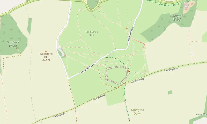
- S National Trust White Horse Hill car park
- 1 Uffington Castle
- 2 Dragon Hill
- 3 The Manger viewpoint
- 4 White Horse
Getting there from Wantage and where to park
Uffington is the nearest village the site covers, 9.5 km west of Wantage Market Place, roughly 6 miles as the crow flies. By road you follow the lanes along the foot of the Downs, so the drive is longer than the map distance suggests.
The usual start for an Uffington White Horse walk is the car park below the hilltop. The hill and the car park are looked after by the National Trust, and access, charges and closures can change, so check its own page before you set off: National Trust, White Horse Hill.
There is no railway station in Wantage or Grove, and the nearest mainline station is Didcot Parkway to the east, so nearly everyone arrives by car or bike. A station for Wantage and Grove is proposed (proposed, at the last check November 2025), which would change that if it is ever built.
What is on the hilltop
Three monuments sit close together, and most visitors see all three in the same hour. The horse is the draw, but the hillfort gives the views and Dragon Hill gives the story.
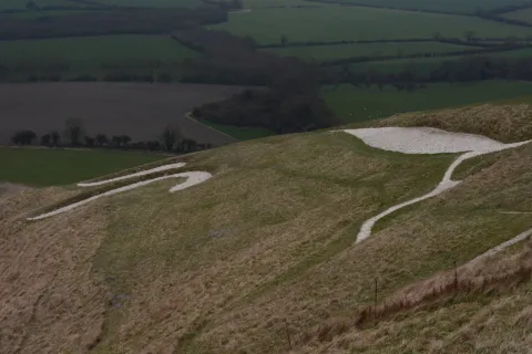
The white chalk lines of the Uffington White Horse on the hillside above the Vale Photo: Andrew Gray, CC BY-SA 4.0, via Wikimedia Commons 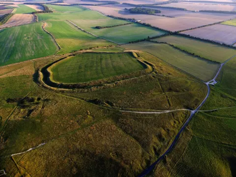
Aerial view of the oval ramparts of Uffington Castle hillfort on White Horse Hill Photo: Dave Price, CC BY-SA 2.0, via Wikimedia Commons 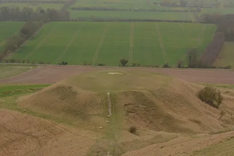
The flat-topped chalk knoll of Dragon Hill below White Horse Hill, with fields beyond Photo: Andrew Gray, CC BY-SA 4.0, via Wikimedia Commons
The horse itself is cut through the turf into the chalk beneath, on a steep slope facing out over the Vale. It is thought to be around 3,000 years old, which puts it in the late Bronze Age or early Iron Age, and it is the oldest of Britain’s chalk hill figures. From directly above you see a curve of back and a leg or two; the full outline only comes together from lower ground.
Uffington Castle stands on the crown of the hill: an Iron Age hillfort ringed by a bank and ditch, with grass inside and the Ridgeway passing close by. The ramparts are the obvious place to sit out of the worst of the wind.
Below the horse is Dragon Hill, a natural chalk mound with a flat top and a bare patch where grass does not grow. The horse, the hillfort and Dragon Hill are protected as a scheduled monument, so keep to the paths, stay off the chalk lines and leave the banks as you found them.
Good to know: this is the highest ground in Oxfordshire, so the wind can bite even on a warm afternoon.
The legend behind the chalk horse
Ask locally and you will hear several stories, none of them provable. The best known explains the bare chalk on Dragon Hill: this, people say, is where St George killed the dragon, and the blood poisoned the ground so nothing will grow.
Others argue the figure is a dragon rather than a horse, or a mare tied to an older goddess. A later tale connects it to King Alfred and a victory over the Danes, which suits a town that calls itself King Alfred’s town; there is more in the history of Wantage.
The one certainty is the upkeep. A chalk figure disappears under grass within a few years, so for centuries villagers held a scouring: they cleaned out the lines and turned the day into a hill fair with games and stalls. The horse is still cleaned and rechalked, which is why it reads white from miles away.
Further west along the ridge, Wayland’s Smithy has a legend of its own. Leave a coin at the long barrow, the story goes, and the invisible smith will shoe your horse by morning.
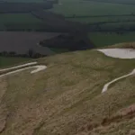 The Uffington White HorseBritain's oldest known chalk hill figure, cut into White Horse Hill some 3,000 years ago and…
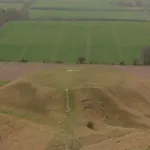 Dragon Hill and the Manger, UffingtonA flat-topped chalk knoll where St George is said to have slain the dragon, beside the…
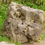 The Blowing Stone, Kingston LisleA perforated sarsen at the foot of Blowingstone Hill that booms when blown, linked in legend…
What to take
Nothing technical is needed, but the hill is open and the ground changes with the weather.
- Shoes with grip. Wet chalk is slippery, and in summer the ruts bake hard and uneven.
- A windproof layer, even in June, because there is no shelter along the ridge.
- Water and a snack. Nothing is sold on the hill.
- A lead for the dog, since sheep and cattle graze parts of the Downs.
- A map or a charged phone if you plan to follow the Ridgeway beyond the hillfort.
- Patience with parking at weekends and bank holidays; if the car park is full, come back later rather than blocking the lane.
Making a day of it on the Ridgeway
The Ridgeway runs along the top of the hill, which is why so many routes meet here. You can extend an Uffington White Horse walk in either direction along the ridge: see the Ridgeway National Trail pages for the wider route.
Head east and the ground above Letcombe Bassett gives you the Devil’s Punchbowl and Hackpen Hill at 5.3 miles (8.5 km), and Segsbury Camp and the Wantage Monument at 8.5 miles (13.7 km). Both are graded moderate, and both are closer to town than White Horse Hill if you are short of driving time.
The Ridgeway routes starting from Letcombe Bassett, south west of Wantage, are listed here, shortest first.
- Letcombe Brook, Letcombe Bassett and Green Road 3.6 miles · Moderate
- The Devil’s Punchbowl and Hackpen Hill 5.3 miles · Moderate
- Segsbury Camp and the Wantage Monument 8.5 miles · Moderate
After the walk
There is no café on the hill, and village pubs out this way keep their own hours, especially midweek and in winter. Ring ahead if lunch is part of the plan.
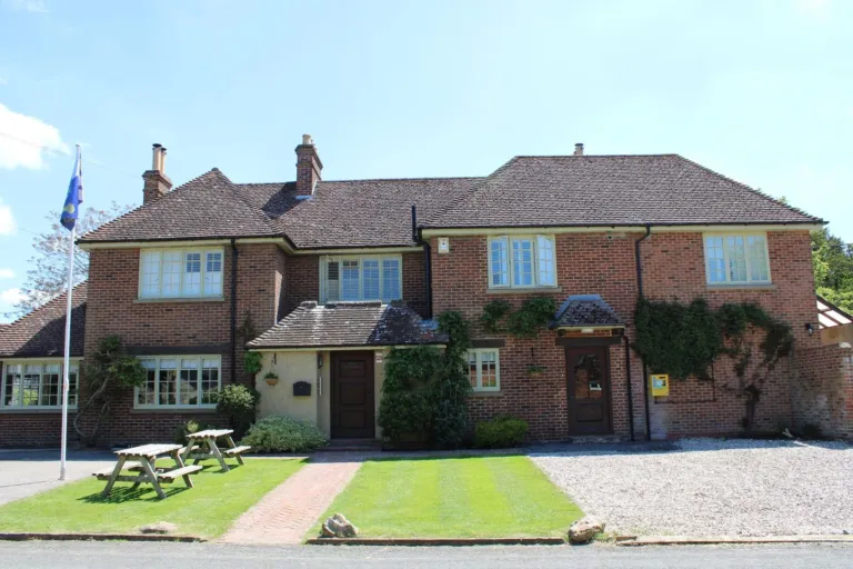
If nothing suits, Wantage is a short drive east and has more choice within walking distance of the Market Place. The directory groups places by kind, so the pub listings are a quick way to see what is near you.
Before you set off
Two things are worth a look on the morning itself: the forecast, because the top is exposed in any season, and the car park, because access can change. A rough order for a first visit:
- Pick the route length to suit your group, using the walk pages.
- Check the weather, then add a layer anyway.
- Check the National Trust page for car park access that day.
- Allow sitting time at the top, not just walking time.
- Sort food out before or after, since there is nothing to buy on the hill.
From here, all the mapped walks are listed shortest first, and What’s on carries dated events if you are building a weekend around the trip. wantage.com is an independent local guide, and every page invites corrections if you spot something out of date.


