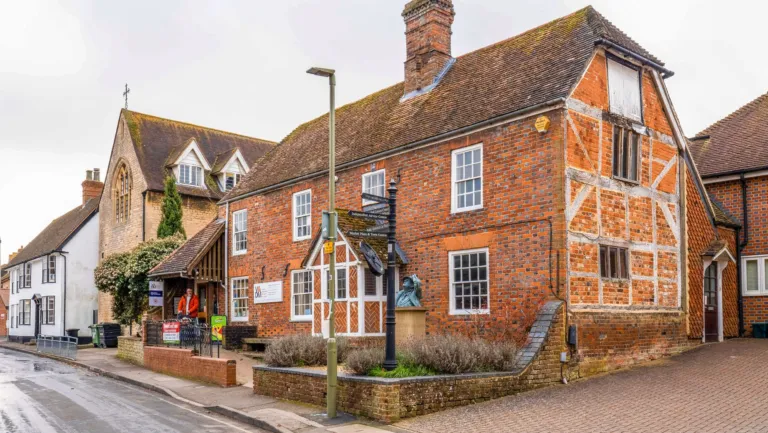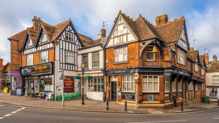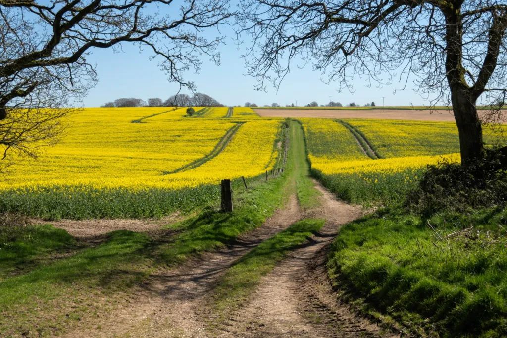
This guide is for anyone who rides from the town: parents after a flat loop with the children, riders who want a long day on the chalk, and people who just need a bike fixed. Cycling in Wantage splits neatly in two, with flat vale lanes and villages to the north, and a climb onto the ridge to the south. Below you will find ride ideas with real distances, where bikes are allowed on the Ridgeway, what to carry, and which pages on the site stay current for shops, clubs and new routes.
The short version
- North of town the ground is flat. Charlton, Grove, the Hanneys and the Hendreds all sit within a few miles of Wantage Market Place.
- South of town you climb, through Letcombe Regis or Childrey, onto the ridge where the Ridgeway runs east to west.
- West of Streatley much of the Ridgeway follows byways and bridleways, so bikes are allowed on a good deal of it. Check the trail’s own guidance for the section you want.
- For servicing, repairs, electric bikes or a second-hand bike, use the directory rather than a fixed list on this page.
- Link roads and the walking and cycling plan will change how riders get in and out of town, so follow the development pages for the current status.
Cycling in Wantage: what the roads and tracks are like
The town sits at the foot of the chalk escarpment, so the riding changes within a mile or two of the Market Place. Ride north and the lanes run flat across the Vale of White Horse through Grove, the Hanneys and Denchworth. Ride south or south-west and you go up, with the Ridgeway along the top and open fields either side.
That shape shows in the way the local walking routes are graded. Routes that start in the vale, such as the old canal line and the Hendreds, are marked easy; the ones that reach the ridge are moderate or challenging. The same logic works on two wheels. Take the climb while your legs are fresh and save the flat lanes for the way home.
Good to know: the lanes between the villages are narrow in places, with hedges and blind bends, so plan junctions rather than speed.
Village rides and how far they are
Most rides from town are village-to-village. The distances below are straight-line from Wantage Market Place, so the road route is always longer, but they show how close everything is and which direction means hills.
| Where | Direction | Straight-line distance | What the ride is like |
|---|---|---|---|
| Charlton | East | 0.8 miles (1.3 km) | Flat, the shortest hop out of town |
| Grove | North | 1.3 miles (2.1 km) | Flat, estate roads and vale lanes beyond |
| East Challow | West | 1.1 miles (1.8 km) | Flat, towards the line of the old canal |
| Letcombe Regis | South-west | 1.4 miles (2.2 km) | Gentle rise, the way up to the Downs |
| Childrey | West | 2.3 miles (3.7 km) | Flat lanes under the escarpment |
| East Hendred | East | 3.9 miles (6.3 km) | Vale lanes along the foot of the hills |
| Uffington | West | 5.9 miles (9.5 km) | Longer run west, with White Horse Hill above |
String two or three of these together and you have an afternoon. The Lockinges and Ardington to the east, and Denchworth and Lyford to the north, add length without adding much climb.
The Ridgeway above the town
Yes, you can ride a lot of the Ridgeway near here, but not all of it. West of Streatley, which includes the whole stretch above Wantage, the trail largely follows byways and bridleways where bikes and horses are allowed. East of Streatley much of it is footpath, so no cycling. The National Trail’s own site sets out which sections are open to bikes: see the Ridgeway National Trail guidance before you plan.
Planning a Ridgeway ride from Wantage
- Pick your way up: lanes through Letcombe Regis or Childrey both climb to the ridge
- Check your section is byway or bridleway, not footpath (west of Streatley is mostly rideable)
- Read the walk page for your target landmark to judge the ground
- Fix your turnaround point before you leave — the ridge runs far east and west
- Leave time and light for the return descent into town, exposed to ridge wind
The surface is chalk and flint. In summer it runs fast and dusty with hard ruts; after heavy rain the chalk turns slick and the ruts hold water. A gravel bike or a mountain bike handles it far better than narrow road tyres.
A first ride up there is easier if you work through it in order:
- Pick your way up. The lanes through Letcombe Regis or Childrey both climb towards the ridge and both start within a few miles of the Market Place.
- Check the status of the section you want, so you know it is byway or bridleway rather than footpath.
- Read the walk page for the landmark you are aiming at, such as Segsbury Camp and the Wantage Monument, to see how the ground sits.
- Fix your turnaround point before you leave, because the ridge keeps going west past White Horse Hill and Uffington Castle and east towards Goring.
- Leave time and light for the return, which is mostly downhill into town but exposed to whatever wind is on the top.
Scouting the tracks on foot
Walking a stretch first is the cheapest way to learn which tracks are rideable in which month. The site’s mapped walks use the same byways, bridleways and lanes that riders use, and each page gives the distance, the climb, where to park and step-by-step directions, so you can judge gradients and gates before you take a bike up.
Shorter routes from the vale are the gentler introduction; the ridge routes show you the surface you will meet on a long day out.
- White Horse Hill, Uffington Castle and Dragon Hill 1.7 miles · Moderate
- Letcombe Brook, Letcombe Bassett and Green Road 3.6 miles · Moderate
- Woolstone, Wayland’s Smithy and the White Horse 5.1 miles · Moderate
- The Devil’s Punchbowl and Hackpen Hill 5.3 miles · Moderate
- Ashbury, Ashdown House and Alfred’s Castle 7.4 miles · Moderate
- Segsbury Camp and the Wantage Monument 8.5 miles · Moderate
- The Ridgeway from White Horse Hill to Wantage 9.7 miles · Challenging
For the full set, including the long Ridgeway days such as White Horse Hill to Wantage, open the mapped walks section.
Quieter rides with children and new riders
Flat and short is the answer here, and the vale gives you both. Charlton is the closest village to the east, the Lockinges and Ardington carry on along the same flat line, and the lanes west towards East Challow and Childrey stay level under the hills. Keep to the quieter lanes and pick a destination the children can picture, such as a village green or a café.
The estates on the edge of town help too. Kingsgrove, north-east of Wantage, was being built at the last check in September 2026 and its plans include a central park, which gives space away from through traffic while the roads are still quiet.
Somewhere to stop makes a short ride feel like a trip. These places in town are listed in the cafés category, with their own opening patterns on each page.
- BBrews and Books CaféCafés & tearooms · WantageAccessible toilet · Garden or outdoor seating · Step-free access
- CColombia CoffeeCafés & tearooms · Wantage
 Costa CoffeeCafés & tearooms · Wantage
 Down to Earth Community CafeCafés & tearooms · Wantage
 Marmalade Coffee ShopCafés & tearooms · Wantage
 The Bay Tree CaféCafés & tearooms · Wantage
What to carry and check before you go
Weather changes the tracks far more than it changes the lanes, so most of the planning for cycling in Wantage comes down to picking the right surface for the day. Run through this before a ride onto the Downs:
- A spare tube, a pump and the tools to fit it, because flint sits in the chalk tracks.
- Lights front and back if there is any chance of finishing after dusk.
- Enough water and food for the whole loop; there are no shops along the ridge.
- Your route saved offline on a phone or head unit, as signal on the tops can be patchy.
- Old kit or mudguards after rain, since chalk mud sticks to everything.
- A bail-out plan down into the vale if the wind or weather turns.
Tip: after two or three dry days the ridge tracks ride well; after a wet week the flat lanes north to Grove and the Hanneys are the better bet.
Bike shops, repairs and servicing in Wantage
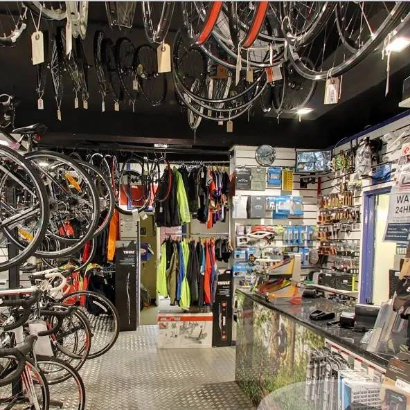
For a puncture, a gear service, a wheel rebuild, an electric bike check or a second-hand bike, start with the local business directory and open the page for the shop or mechanic you are considering. Each listing carries the contact details, location and opening pattern given by the business, which is more reliable than a list typed out here.
It pays to ring or message first. Workshops book up, and parts for electric bikes and hydraulic brakes are not always on the shelf. If you are shopping for a bike rather than a repair, it also helps to say what you want it for, since a bike for the ridge and a bike for the school run are different machines.
Listings on this site are free, and any Featured listing is labelled, so what appears in a guide is not affected by payment. If a shop has changed its details, every page invites a correction.
Clubs, group rides and sport sessions
Riding with other people is the quickest way to learn the lanes and the bridleways. Clubs and groups in Wantage, Grove and the villages list their sessions under sport in What’s on, and anything with a date shows below.
If nothing is showing for the week you are looking at, check the wider sport listings, which also cover one-off events and seasonal fixtures. Organisers add their own dates, so times and meeting points come from them.
New roads, the cycling plan and where to look next
Two sets of changes will shape cycling in Wantage over the coming years: the link roads around the edge of town, and the plan for walking and cycling routes. King Alfred Way, the Wantage Eastern Link Road, was complete at the last check in December 2024 and runs along the east side of town.
North of town, the Grove Northern Link Road was approved at the last check in September 2026, with one section coming forward as part of Monks Farm, where the plans include a bridge over the Letcombe Brook. The Wantage and Grove walking and cycling plan sets out the routes the councils want to improve and was in planning at the last check in October 2025.
Statuses move, so treat the dates above as a snapshot and open the page for the live position.
- Grove Northern Link RoadApproved (Sep 2026)Developers of Monks Farm
- King Alfred Way (Wantage Eastern Link Road)Complete (Dec 2024)Oxfordshire County Council
Before you set off, do two quick checks: the weather for the surface you have chosen, and the page of any shop, café or club you are relying on, in case the hours have changed. Then pick where to go next:
- The walks pages for distances, climbs, parking and directions on the ground you want to ride.
- Grove and the other village pages for what is in each place before you plan a turnaround.
- Developments for the roads, estates and routes that will change the way in and out of town.