This page is for anyone planning a tent, campervan or glamping break in this corner of Oxfordshire, and for locals sorting out somewhere for visiting family to stay. Camping near Wantage mostly means small sites on farmland in the surrounding villages rather than a large holiday park in the middle of town. You get the lie of the land, the rules on wild camping, the walks worth planning a weekend around, and a short list of things to check before you book.
The short version
- Pitches tend to sit out in the villages, a few minutes’ drive from the town centre, with the chalk escarpment on the skyline to the south.
- Wild camping is not a right in England, so you need the landowner’s permission before you pitch.
- Glamping usually means a hut, pod or furnished tent with bedding provided, so you can travel light.
- Mapped walks start from several nearby villages, from 1.7 miles (2.7 km) at White Horse Hill to a 15.8 mile (25.4 km) stretch of the Ridgeway.
- Shops, pubs and cafés are in the town and in Grove, so plan one supply stop on the way in.
Where to look for camping near Wantage
Look to the villages rather than the town centre. The land south and west of Wantage climbs towards the chalk downs, and the lanes that way run through small settlements with working farms, which is the kind of land that suits a field of pitches or a couple of huts.
East of town the Downs carry on along a line of spring-line villages. East Hendred is 6.3 km east of Wantage Market Place, and that side of the parish sits handy for both the escarpment and the A34 corridor.
North is different country: flatter, with the old canal line and the brooks. Grove is 2.1 km north and the Hanneys lie beyond it, so a pitch up there is better for easy cycling and low-level walking than for big climbs.
The table below pairs five villages with a walk that starts in or near them, so you can choose where to stay by what you want to do on the Saturday morning.
| Village | From Wantage Market Place | A mapped walk that starts there |
|---|---|---|
| Ardington | 3.4 km east | The Hendreds and Ardington, 4.3 miles (6.9 km), easy |
| Childrey | 3.7 km west | Childrey and the Challows from Wantage, 7.2 miles (11.6 km), easy |
| Letcombe Bassett | 3.8 km south-west | Letcombe Brook, Letcombe Bassett and Green Road, 3.6 miles (5.8 km), moderate |
| Uffington | 9.5 km west | White Horse Hill, Uffington Castle and Dragon Hill, 1.7 miles (2.7 km), moderate |
| East Hendred | 6.3 km east | West Ilsley, Scutchamer Knob and the Ridgeway, 5.7 miles (9.2 km), moderate |
Tents, glamping or a campervan
The three suit very different trips, and the practical difference is how much you carry and what you need from the site. A tent pitch on farmland is the cheapest and most flexible option, but you want to know whether there is drinking water, a loo and a shower block, and how far you have to walk from the car to the pitch.
Glamping in this area usually means a shepherd’s hut, a cabin, a pod or a furnished bell tent. Bedding and a bed are normally part of it, which makes it a good choice for a first night outdoors with small children, or for a couple arriving by train and taxi. Ask what cooking kit comes with the hut, because some have a proper kitchen and others expect you to bring a stove.
For a campervan or caravan, the questions are access and power: whether the track is firm in wet weather, how tight the gateway is, and whether pitches have an electric hook up. Small, members-only sites are common in Oxfordshire and often take only a handful of vans at a time, so they fill early for bank holidays.
Tip: if you are travelling with a dog, check the dog rules and the stock in the next field before you book, not after you arrive.
Wild camping near Wantage: what the law allows
You cannot simply pitch where you like. In England there is no general right to wild camp, with Dartmoor the long-standing exception, so camping anywhere around here needs the permission of whoever owns the land. That applies to the Ridgeway and the fields either side of it, to woodland, and to the verges of the byways on the top of the Downs.
The Ridgeway is a National Trail, which gives a right of way along it and nothing more. Walkers doing the trail in stages usually book a pitch, a hut or a room at the end of each day and leave the trail to reach it. Official guidance for the route is published by the trail team.
The Countryside Code sets out the rest: close gates, keep dogs under control near livestock and ground-nesting birds, take litter home, and do not light fires. Both points are covered in the government’s own guidance.
You can read the Countryside Code on GOV.UK, and route information for the trail on the National Trail site.
Camping rules explained: 3-3-3, 4-4-4 and the 200 rule
These three rules come up a lot in searches, and they are rules of thumb rather than law. Two of them were written for long motorhome tours in North America, so only part of each is useful on a weekend in Oxfordshire.
- The 3-3-3 rule: drive no more than about 300 miles in a day, arrive by 3pm, and stay at least three nights. The half worth keeping here is arriving in daylight, because the lanes up to the Downs are narrow and unlit.
- The 4-4-4 rule: the same idea stretched a little: up to 400 miles, off the road by 4pm, four nights in one place. Again, it is about not arriving tired and setting up in the dark.
- The 200 rule: pitch, wash and bury waste at least 200 feet, roughly 60 metres, from streams, paths and roads. It is leave-no-trace guidance for wild camping, and it matters locally because the chalk streams, including the Letcombe Brook, are clean and easily spoiled.
On a booked site, the site’s own rules replace all of this: follow the pitch spacing, the quiet hours and the fire policy you are given.
Walks to build the weekend around
The big draw is the escarpment and the trail that runs along it. The shortest and best known route is White Horse Hill, Uffington Castle and Dragon Hill at 1.7 miles (2.7 km), which works even with young children. At the other end, the Ridgeway from White Horse Hill to Wantage is 9.7 miles (15.6 km) and rated challenging, so it suits a full day with a lift arranged at one end.
In between there is plenty of easier going: brook-side paths, the old canal arm west of town, and the estate tracks east towards the Lockinges. Pick by distance and by how much climbing you want, then check the parking note on the walk page before you set off.
Here are some shorter routes near town, shortest first.
- White Horse Hill, Uffington Castle and Dragon Hill 1.7 miles · Moderate
- Letcombe Brook, Letcombe Bassett and Green Road 3.6 miles · Moderate
- Woolstone, Wayland’s Smithy and the White Horse 5.1 miles · Moderate
- The Devil’s Punchbowl and Hackpen Hill 5.3 miles · Moderate
- Ashbury, Ashdown House and Alfred’s Castle 7.4 miles · Moderate
- Segsbury Camp and the Wantage Monument 8.5 miles · Moderate
- The Ridgeway from White Horse Hill to Wantage 9.7 miles · Challenging
The full set, with distances, climbs and step-by-step directions, is on the mapped walks pages.
Supplies, a pub meal and a hot drink
Plan one stop in town. The market place and the streets around it hold the main shops, and a weekend of camping near Wantage is a lot easier if you buy food, milk and gas before you head up the hill, because the village shops keep shorter hours.
For an evening out, the pubs in town and in the villages are the obvious choice, and several do food. Opening patterns vary by day and by season, so it is worth ringing if you are a group.
 The Greyhound InnPlaces to stay · Letcombe RegisBreakfast · Dog friendly · Family friendly
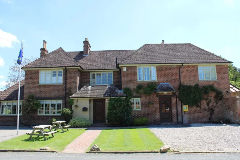 The Blowing Stone InnPlaces to stay · Kingston Lisle
- TThe Fox and Hounds, UffingtonPubs & bars · Uffington
 The Boar’s HeadPubs & bars · ArdingtonGarden or outdoor seating · Sunday lunch
 The WheatsheafPubs & bars · East HendredDog friendly · Garden or outdoor seating · Private hire
 The Eyston ArmsPubs & bars · East HendredFamily friendly · Garden or outdoor seating · Private hire
If you want breakfast out, or somewhere dry to sit while a shower passes, browse the cafés in the directory and check the day you plan to visit.
Getting here, and camping between Wantage and Didcot
Almost everyone arrives by road. There is no railway station in the town or in Grove; a station for Wantage and Grove has been proposed, and at the last check, November 2025, it was still at the proposal stage. The nearest mainline stations are to the north-east, so a taxi or a lift usually finishes the journey.
Coming off the A34 and the A417, King Alfred Way, the eastern link road, carries traffic round the east side of town and was completed in December 2024. It helps if you are towing, because it keeps you out of the narrow streets near the centre.
If your trip is based on Didcot or Abingdon, the villages between there and here are still an easy drive: Harwell is 9.4 km east of Wantage Market Place and Milton 9.8 km north-east, both of them a short hop from the Didcot side while still giving you the Downs on your doorstep.
What to check before you book
Small sites change what they offer from season to season, so run through this list with the site’s own website or a phone call before you commit.
Before You Book: What to Check
- Pitch type: grass, hardstanding, or hut with bedding
- Electric hook-up availability
- Facilities: water, toilets, showers (open out of season?)
- Fire policy: open fires, fire pits, BBQ off ground, or none
- Dogs: allowed, lead rules, livestock in neighbouring fields
- Access: gateway width, track surface, van turning space
- Arrival times, quiet hours, group acceptance policy
- Mobile signal availability
- Pitch type: grass, hardstanding, or a hut with bedding provided.
- Power: whether an electric hook up is available, and how many are left.
- Facilities: drinking water, toilets, showers, washing up, and whether they are open out of season.
- Fires: open fires, fire pits, barbecues off the ground, or none at all.
- Dogs: allowed or not, lead rules, and the livestock in neighbouring fields. The dog friendly places list is a useful cross-check for pubs and cafés on the same trip.
- Access: gateway width, track surface, and whether a long wheelbase van can turn.
- Arrival times, quiet hours and whether groups or single-sex parties are accepted.
- Mobile signal, if you need it for work or for maps.
Good to know: ground on the chalk drains fast, but the clay fields north of town hold water, so ask about the state of the field after heavy rain.
Before you set off, and where to look next
Hours, prices and availability move about, so always confirm with the site itself on the day you plan to travel. Then work through the trip in order.
- Choose your side of the hill: downland villages for climbs and views, the flatter land north for easy cycling and brook paths.
- Book the pitch or hut, checking power, fires and dogs at the same time.
- Pick one walk per day from the mapped routes and note where to park.
- Plan a supply stop in town on the way in, and one pub meal.
- Check the forecast the night before and pack for wind on the open top of the Downs.
For dated things to fit around a weekend of camping near Wantage, from markets to music nights, see what’s on. If a detail on this site has changed, you can report it on the page it appears on; corrections are welcome.